
This evening finds us in a rare moment of atmospheric zen. High pressure is sitting directly along the Mid-Atlantic coast, gifting us nearly clear skies and light winds. If you were outside this afternoon, you felt it—temperatures topping out near 70°F with low humidity made for a perfectly comfortable setup.
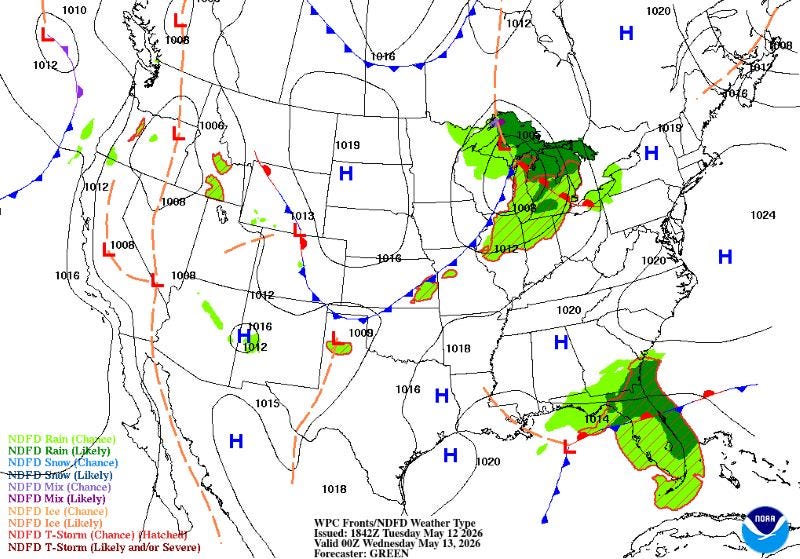
However, enjoy the calm while it lasts. Change is moving in tonight.
The Midweek Shift
As the high moves offshore tonight, a cold front will begin its approach from the Great Lakes. We’ll see a brief window right after sunset where the winds stay light—perfect for a quick bout of radiational cooling that could dip inland temperatures into the mid-to-upper 40s.
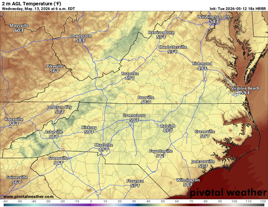
But don’t expect it to stay there; as the pressure gradient tightens, southerly winds will kick up, nudging temperatures back into the lower 50s by dawn.
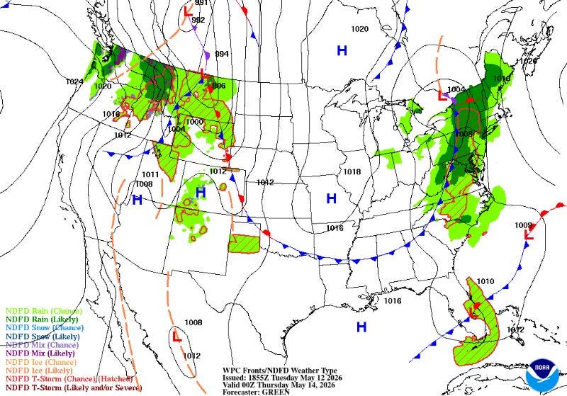
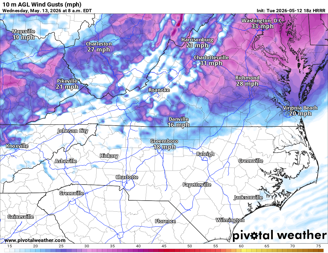
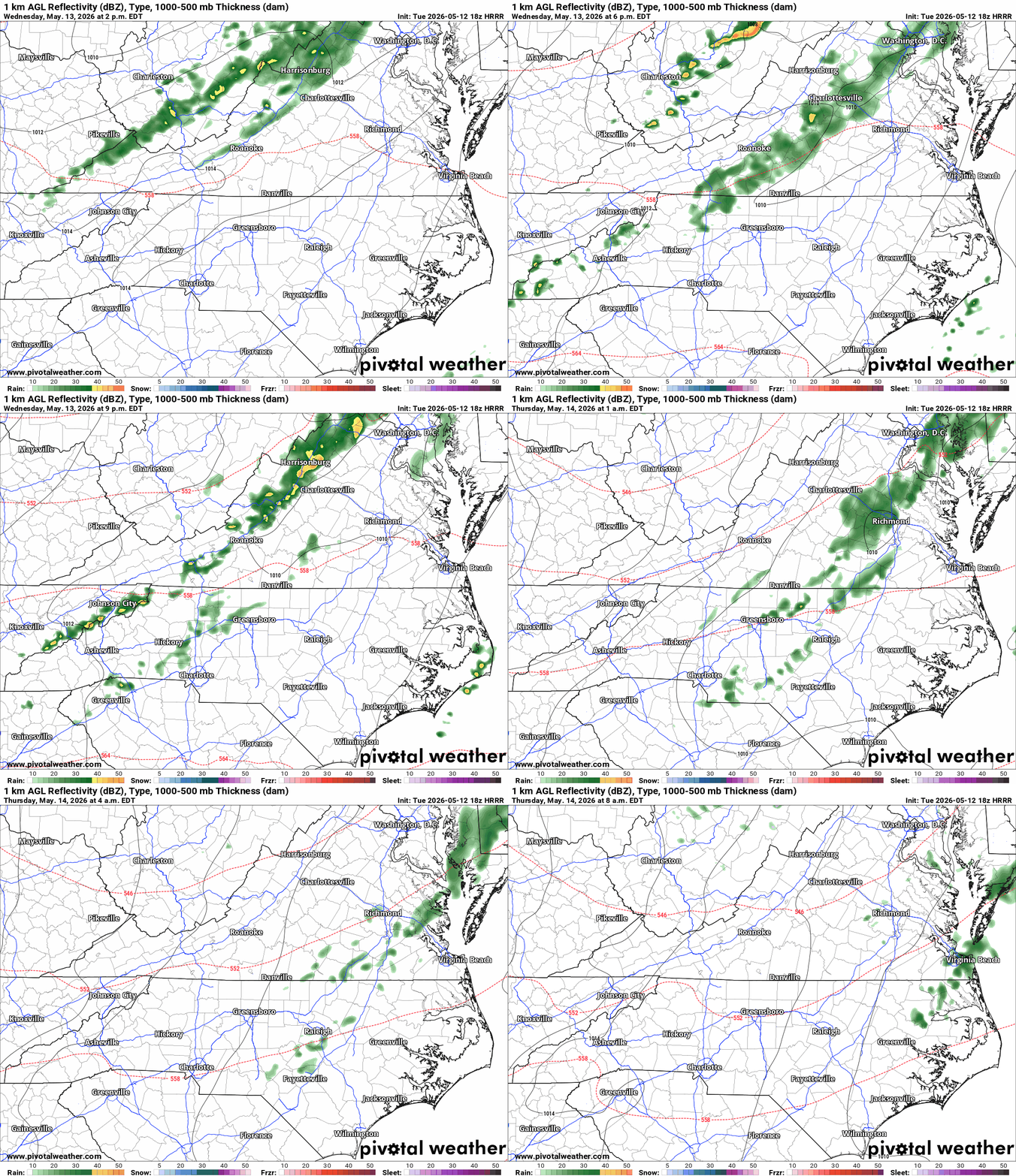
Wednesday will be the transition day. It starts breezy (gusts up to 25 kt), but by late afternoon and evening, the front arrives.
Rainfall: Expect showers and perhaps a stray rumble of thunder.
The Catch: Latest data suggests the front is slowing down, which actually limits the “juice” available for big storms. Most areas east of I-95 are looking at less than 0.10” of rain, though folks further north might see up to a quarter inch.
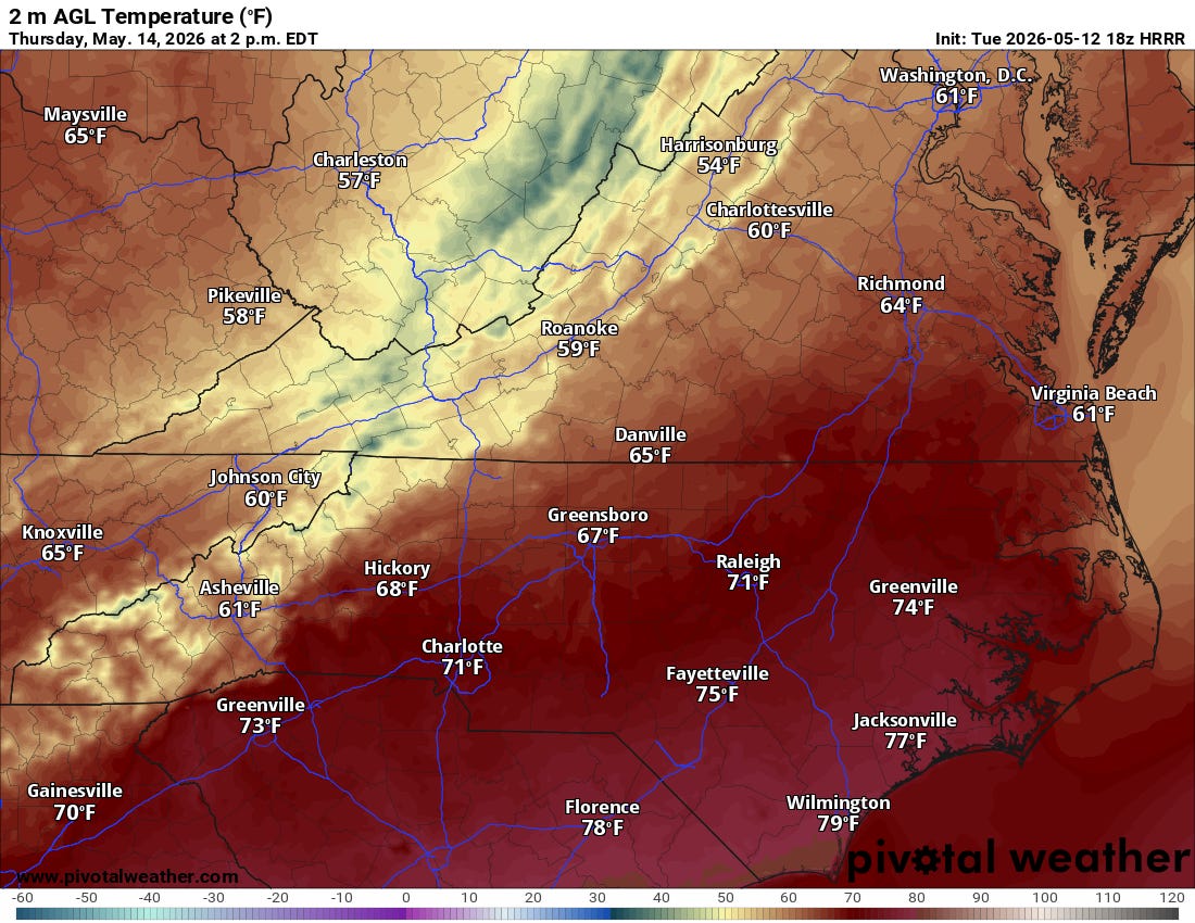
Thursday: We’ll wake up to a cooler reality. With an upper-level low parked over the NE, Thursday highs will struggle to reach normal, staying 5-10 degrees below.
Marine & Aviation Update
For the boaters and pilots in the audience, take note:
Aviation: VFR conditions hold through Wednesday morning, but expect flight restrictions late Wednesday as the rain moves in.
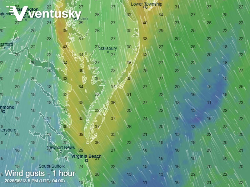
Marine:Small Craft Advisories go into effect starting tonight for the Upper Chesapeake and Wednesday afternoon for the lower Bay and tidal rivers. Expect southerly gusts up to 30 kt and seas reaching 5-6 ft in the northern coastal waters.
Looking Ahead: The Summer Surge
If you aren’t a fan of the midweek chill, hold on until the weekend. The weather patterns are shifting significantly. A flat ridge over the southern US is expected to amplify, anchoring itself off the SE coast.
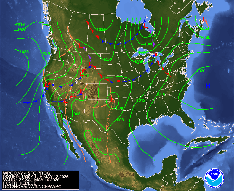
By Saturday and Sunday, we’re trading the light jackets for sunscreen. High pressure offshore will pump warm, southerly air into our region, sending temperatures soaring into the upper 80s and potentially the low 90s by early next week. Given our current dry conditions, hitting those 90-degree marks might be easier than usual.
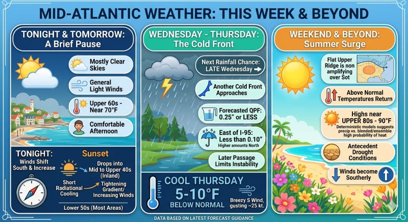
Bottom line: Soak up the 70s tonight, keep the umbrella handy for late Wednesday, and get the AC ready for a hot weekend.