Central Virginia is locked into a full-blown late-summer heatwave today as a formidable upper-level ridge builds overhead, driving afternoon temperatures deep into the mid-90s and pushing heat indices toward dangerous thresholds.
Key Highlights
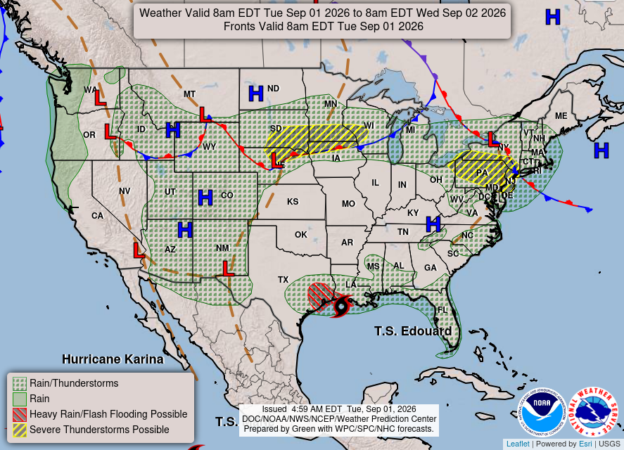
The Heat Dome is Here: A robust 500mb high-pressure ridge parked over the region is providing heavy subsidence, keeping skies clear and suppressing rain chances under 10% through midweek.
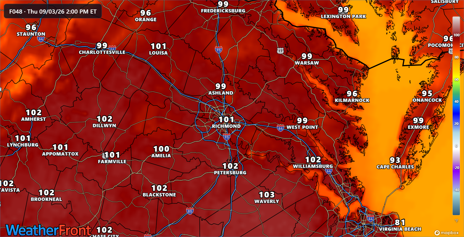
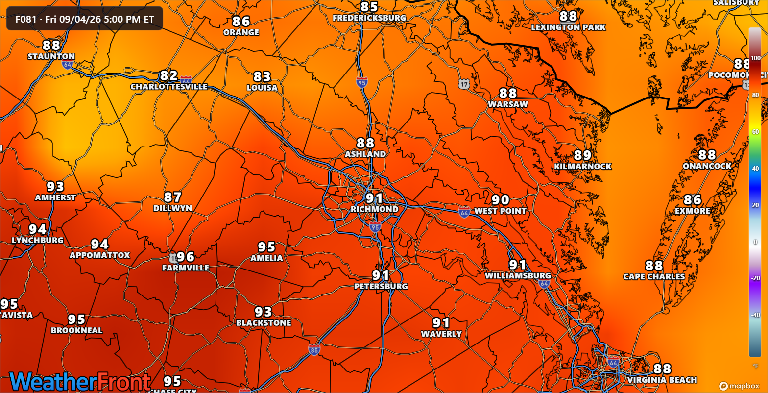
Soaring Temperatures & Heat Risk: High temperatures will reach the low-to-mid 90s today and climb further into the mid-to-upper 90s on Wednesday and Thursday. Dew points lingering in the upper 60s to around 70°F will push peak afternoon heat indices to between 100°F and 105°F, prompting potential Heat Advisories.
Late-Week Pattern Change: Relief is on the horizon. Ensemble guidance points to a cold front approaching by Friday and Saturday, which will finally break the ridge, lower humidity, and return active storm chances to the region.
Detailed Forecast
Today (Tuesday): Sunny and blazing hot. Highs reach the lower to middle 90s with afternoon heat indices peaking near 100°F–103°F. Light and variable winds offer little relief.
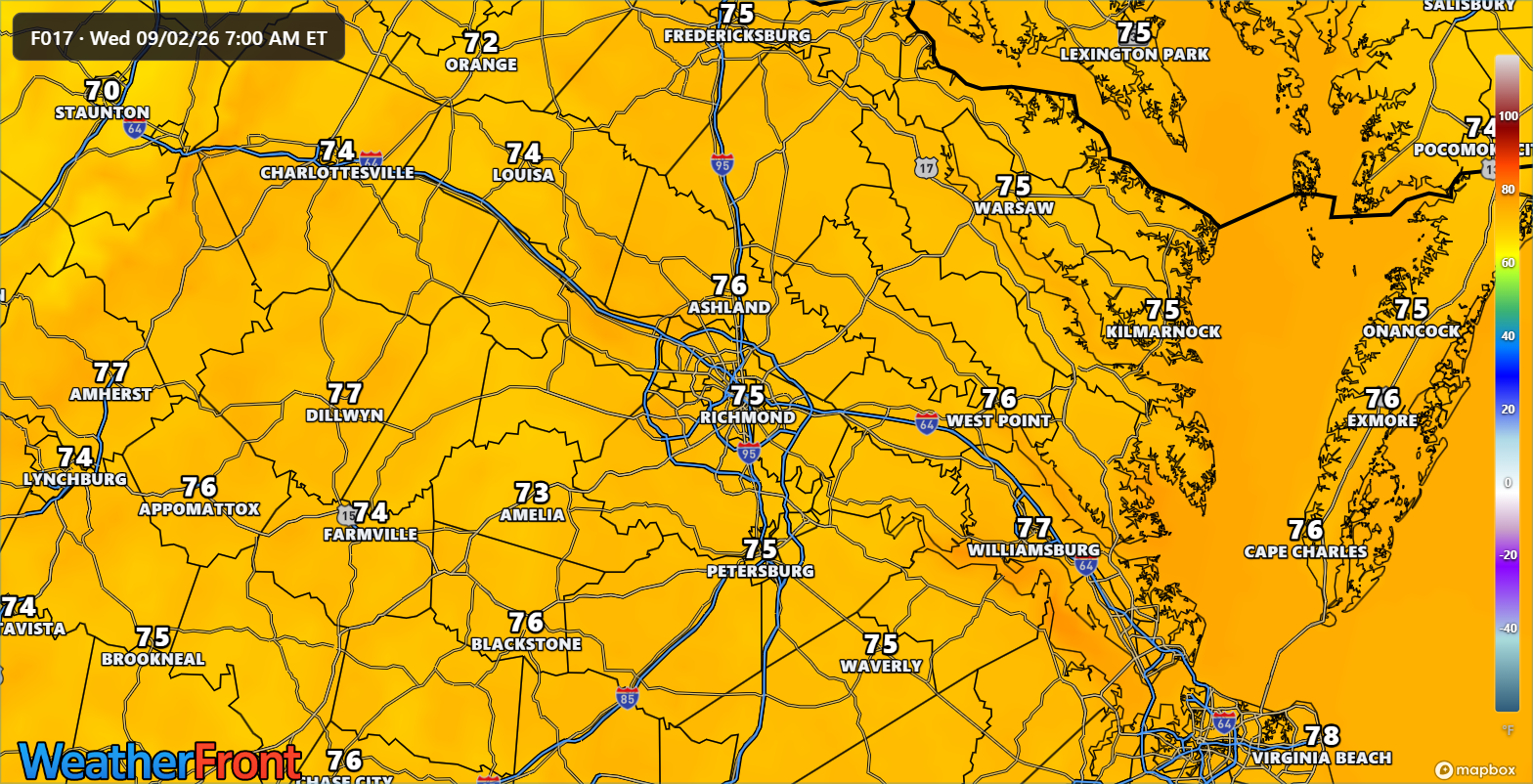
Tonight: Mostly clear, muggy, and warm. Lows will struggle to fall below the low-to-mid 70s in the metro core, providing little overnight cooling.
Wednesday & Thursday: The peak of the heatwave. Expect widespread highs of 94°F to 97°F inland, with some urban spots feeling closer to 100°F+. Completely dry conditions persist under blazing September sun.
Friday & Saturday: Clouds increase as a cold front moves in from the north. Highs ease slightly back into the upper 80s to near 90°F, accompanied by a return of scattered showers and thunderstorms.
Potential Impacts
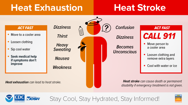
Heat Safety: Extreme heat and high humidity increase the risk of heat-related illnesses for anyone working or exercising outdoors. Limit strenuous outdoor activities during peak heating hours (12 PM – 6 PM), stay hydrated, and check on vulnerable neighbors and pets.
Special Focus: Climate Change and RVA's Weather Patterns
As we experience this intense early-September heatwave, it highlights a profound shift happening across Central Virginia's climate profile:
- Stretching the Summer Season: High-pressure "heat domes" are becoming increasingly stubborn and frequent, lingering longer into what used to be the comfortable transition of early autumn. For Richmond, this means our peak summer heat stress is no longer confined to July and August; it regularly punches well into September, exacerbating our urban heat island effect.
- The Amplified Hydrological Cycle: While this ridge is locking in dry weather right now, a warmer atmosphere holds roughly 7% more moisture per 1°C of warming. When heat domes eventually collapse (as our upcoming Friday front will demonstrate), that massive reservoir of heat and energy translates into increasingly explosive, high-rate rainfall events when storms finally do fire. Understanding these extremes helps us prepare for both intense power grid demands during heatwaves and sudden flash-flooding risks when patterns break.
Specialized Daily Callouts
🌱 Gardening & Soil Brief: Soil moisture is evaporating rapidly under this heat dome. Give container plants, hanging baskets, and sensitive garden beds a deep, thorough soaking early in the morning before the sun bakes the soil.
🚗 Commute & Outdoor Rating: 8/10 for travel conditions (unlimited visibility, dry roads), but 3/10 for comfort. Interior car temperatures will skyrocket within minutes—park in the shade if possible!
🏠 Home & Energy Brief: Your cooling system is working overtime this week. Keep blinds and curtains drawn on south-facing windows during peak afternoon hours, utilize ceiling fans, and delay heavy heat-producing appliance use (like laundry or dishwashers) until late evening.
🚲 Two-Wheel & Runner's Outlook: Strictly a dawn-patrol window. Runners and cyclists should wrap up workouts before 8:30 AM to avoid dangerous heat buildup. Afternoon exercise is strongly discouraged.
📩 Share & Subscribe Call-To-Action
Enjoying these local updates? If this helped you plan your day, share it with a neighbor or subscribe to get every brief delivered straight to your inbox!
Community Support Sign-Off
Thanks for reading the RVA Weather Brief. This service is 100% free and run by a solo creator, so please consider visiting rvaweather.net/social to help cover hosting and data costs.
Community Engagement:
Are you hiding in the AC today or braving the heatwave? Drop your RVA neighborhood below and let us know how hot your thermometer is reading! 👇 Hit that like button if you're already counting down the days until Friday's cool down!