Sunday closed beautiful and dry in the mid 60s, with a broad high-pressure system parked just offshore of the New Jersey coast and the clocks newly turned back. Monday, a shortwave crosses overhead, but it brings only waves of mid- and high-level clouds — the surface stays too dry for rain — and then a ridge builds over the East for Tuesday and Wednesday. That ridge is the payoff: highs climb from the mid-60s to around 70 Monday, to the lower to mid 70s Tuesday, to the mid to upper 70s Wednesday, when interior southern Virginia could approach 80.
KEY HIGHLIGHTS
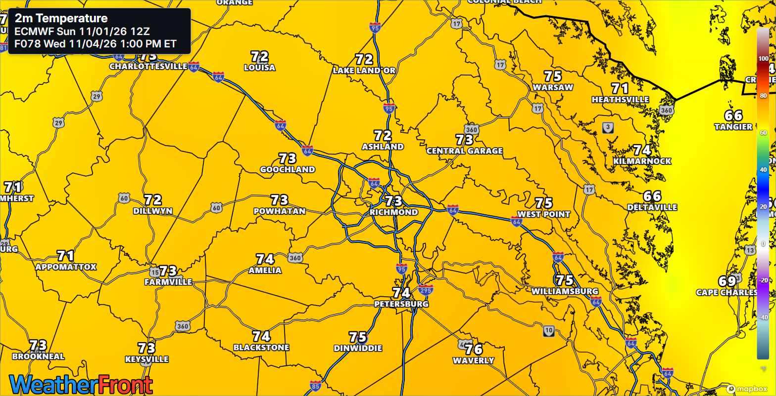
🌡️ The warming ladder: Monday mid-60s to around 70 in the Piedmont and metro, a touch cooler on the Northern Neck and Lower Eastern Shore; Tuesday lower to mid 70s; Wednesday mid to upper 70s, approaching 80 across interior southern Virginia depending on cloud cover.
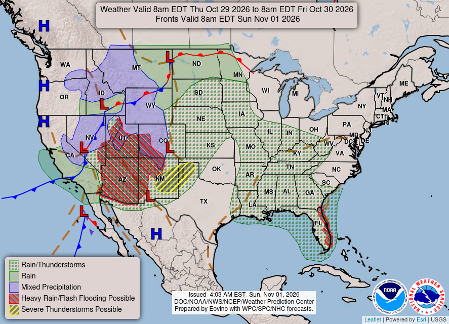
☀️ Dry through Wednesday: A 1034+ mb high offshore and limited surface moisture keep all three days dry and VFR, with no watches, warnings, or advisories in effect for Virginia.
🌙 Nights moderate, no frost or freeze: Lows run through the 40s tonight and Monday night (some upper 30s well inland and on the Maryland Eastern Shore tonight — still a few degrees too warm for appreciable frost), then climb to around 60 by Wednesday night. Shower chances return Thursday-Friday at 40-50%, low confidence, scattered — not a washout. Tropics quiet: NHC expects no formation in the next 7 days.
Will Wednesday feel like November or September?
SPECIAL FOCUS: The Ridge That Warms Us in Steps
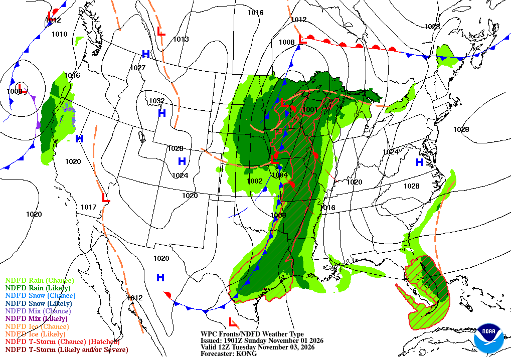
A well-defined high sits just offshore of New Jersey this afternoon while a shortwave ripples through the Tennessee Valley, dragging bands of mid- and high-level cloud across our sky. That shortwave crosses the local area Monday, but there is so little moisture at the surface that it passes as decoration, not weather. Behind it, a ridge builds over the eastern and northeastern United States Tuesday into Wednesday, and each day the dome sits a little more firmly overhead. Translated into plain English: the high is a slow lid that suppresses rain and lets the sun and gentle easterly-to-southerly flow stack warmth day on day — 60s, then low 70s, then upper 70s — until a trailing cold front finally tries us late in the week.
What could change this: If Wednesday's cloud deck runs thicker than expected, highs hold in the mid-70s instead of approaching 80 across interior southern Virginia.
DETAILED FORECAST
Monday (Nov 2): Variable mid- and high-level clouds from the crossing shortwave, dry everywhere. High mid-60s to around 70 in Piedmont/metro, mid-60s in the Northern Neck and Lower Eastern Shore, light E-NE winds 5-10 mph or less. Low in the 40s regionwide. Clouds for show — the dry run holds.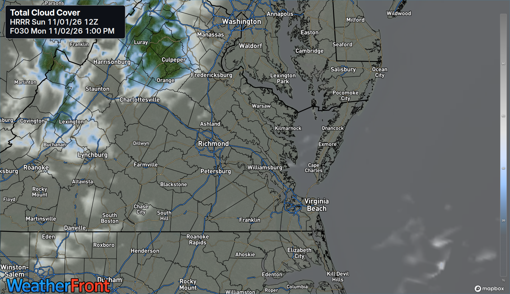
Tuesday (Nov 3): Ridge building overhead, variable cloudiness and dry. Highs lower to mid 70s Piedmont/metro, low to mid 70s Northern Neck, low 70s Lower Eastern Shore, light winds. Low upper 40s to low 50s inland, low 50s at the coast. The step up — November in a lighter jacket.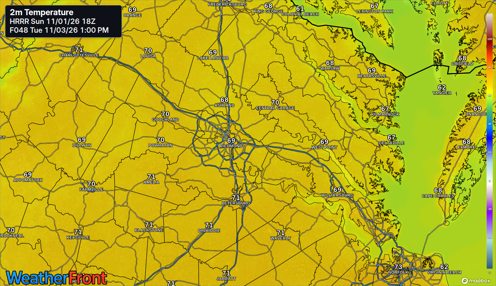
Wednesday (Nov 4): The warmest day, mid to upper 70s Piedmont/metro and approaching 80 across interior southern Virginia, mid 70s Northern Neck and Lower Eastern Shore, variable clouds and light winds. Low around 60 Wednesday night as moisture finally starts returning. September's encore — take the outdoor list outside.
AT A GLANCE
Mon: Variable clouds, dry — 68°
Tue: Dry, warmer — 74°
Wed: Dry, warmest — 78°
Thu-Fri rain chance: 40-50% scattered showers, low confidence — not a washout
SPECIALIZED CALLOUTS
🌱 Gardening & Soil Brief: Dry through Wednesday and no frost or freeze in the window, so covers stay off and soil keeps drying — deep-water early in the week while mornings are cool. Use warm Wednesday for cleanup, mulching, and late planting; lows near 60 Wednesday night end the cold-night pattern for now.
🚗 Commute & Outdoor Rating: 9/10. Dry roads, light winds, and VFR conditions all three days; the only adjustment is the clock — sunset is 5:10 PM Monday, 5:09 PM Tuesday, and 5:08 PM Wednesday, so the evening commute home runs dark.
🏠 Home & Energy Brief: Light heating demand on the 40s nights to start the week, fading fast — by Wednesday night, with lows around 60, most homes need neither heat nor air conditioning. Open windows Tuesday and Wednesday afternoon to bank the warmth.
🚴 Two-Wheel & Runner's Outlook: Tuesday and Wednesday are the pick — dry, light winds, and 70s warmth. Morning miles start in the 40s Monday and low 50s by Wednesday; evening miles need lights, with sunset just after 5 PM all three days.
COMMUNITY ENGAGEMENT
🌡️ Wednesday thermometer check — how warm did it get? Wednesday afternoon, send us your backyard high: 75, 78, or 80+ — plus your neighborhood — and tell us whether your corner of the metro beat the forecast. Drop full reports at https://rvaweather.net/obs. Like this if a near-80 reading in November still surprises you — let's map who warmed the most.
📩 Share & Subscribe: Send this to someone planning yard work or an outdoor job this week — Wednesday's near-80 warmth is the day to schedule around. Get the brief in your inbox: https://rvaweather.net/newsletter
Thanks for reading the RVA Weather Brief — 100% free, from the RVA Weather Network team. Support our work at https://rvaweather.net/social. Built on the latest NWS Wakefield forecast discussion (2:18 PM EST Sun Nov 1, 2026 — the latest available at generation time; no post-3:00 PM discussion had been issued yet), with local context from the RVA Weather Network team. Keep an eye on the sky — and stay safe out there.