
Thursday split Richmond in two — the southeast and Eastern Shore cleared into the upper 70s and low 80s while clouds and light showers held the Piedmont in the low 70s, behind a cold front dragging down the Appalachians. Tonight that front stalls along the I-85 corridor and wrings out air carrying more than twice the usual moisture for early November, bringing widespread rain and a few thunderstorms through Friday. Then the front pushes through and the weekend resets dry and seasonably cool — highs in the low to mid 60s, lows near 40.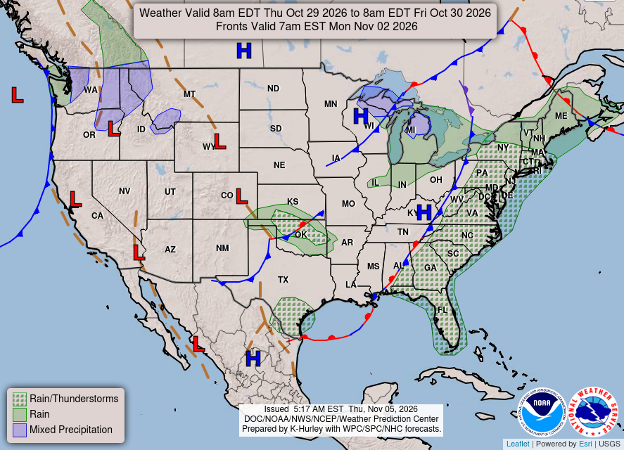
KEY HIGHLIGHTS
🌧️ The soaking arrives tonight-Friday: Widespread moderate to locally heavy rain — upwards of 1 inch in the Piedmont and metro, 1-2 inches from the Middle Peninsula and eastern Northern Neck to the Maryland Eastern Shore, and 1-2"+ in southeast Virginia, 3"+ where storms train. A very localized flash flooding threat rides along; no watches, warnings, or advisories are in effect for Virginia land areas.
⛈️ marginal severe edge in the south: Bulk shear of 35-45 kt and CAPE near 500 J/kg Friday could produce a brief strong gust in a stronger southern storm, with a very small tornado threat — low confidence on both.
🍂 Cool, dry weekend reset: Rain ends Friday evening, then northwest gusts of 20-25 mph Saturday, highs of 61-64 in the metro, and lows in the mid to upper 30s inland to low 40s at the coast. The Bermuda-area low (50% 7-day chance) drifts east — no Virginia impact.
What weather question has waited long enough?
SPECIAL FOCUS: The Stalled Front That Wrings Out the Sky
A cold front draped down the Appalachians should sweep through overnight. This one stalls along the I-85 corridor instead, and a stalled front is a conveyor belt: showers and thunderstorms ride the same boundary over the same ground. Ahead of it, southerly flow has loaded the air to more than 200% of normal November moisture, so each pass rains hard. Translated into plain English: the front is the wringer, the tropical-grade moisture is the soaked towel, and training storms are the wringer passing over the same spot again and again. A low-pressure wave on Friday finally shoves the front offshore.
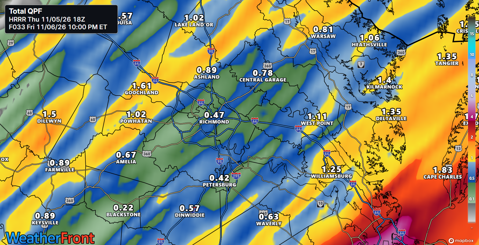
What could change this: If storms train over the metro instead of the east, Richmond totals push past 1 inch, flash flood threat included.
DETAILED FORECAST
Friday (Nov 6): Showers and possibly a thunderstorm before 1 PM, then showers likely, diminishing late afternoon. High near 70 in the metro, upper 60s in the Piedmont, low 70s on the Northern Neck and Lower Eastern Shore. Daytime rain of 0.75-1.00" in the metro; totals reach 1-2" east, 3"+ in southeast Virginia, training storms. Low around 50. The soaking itself — gauges earn their keep.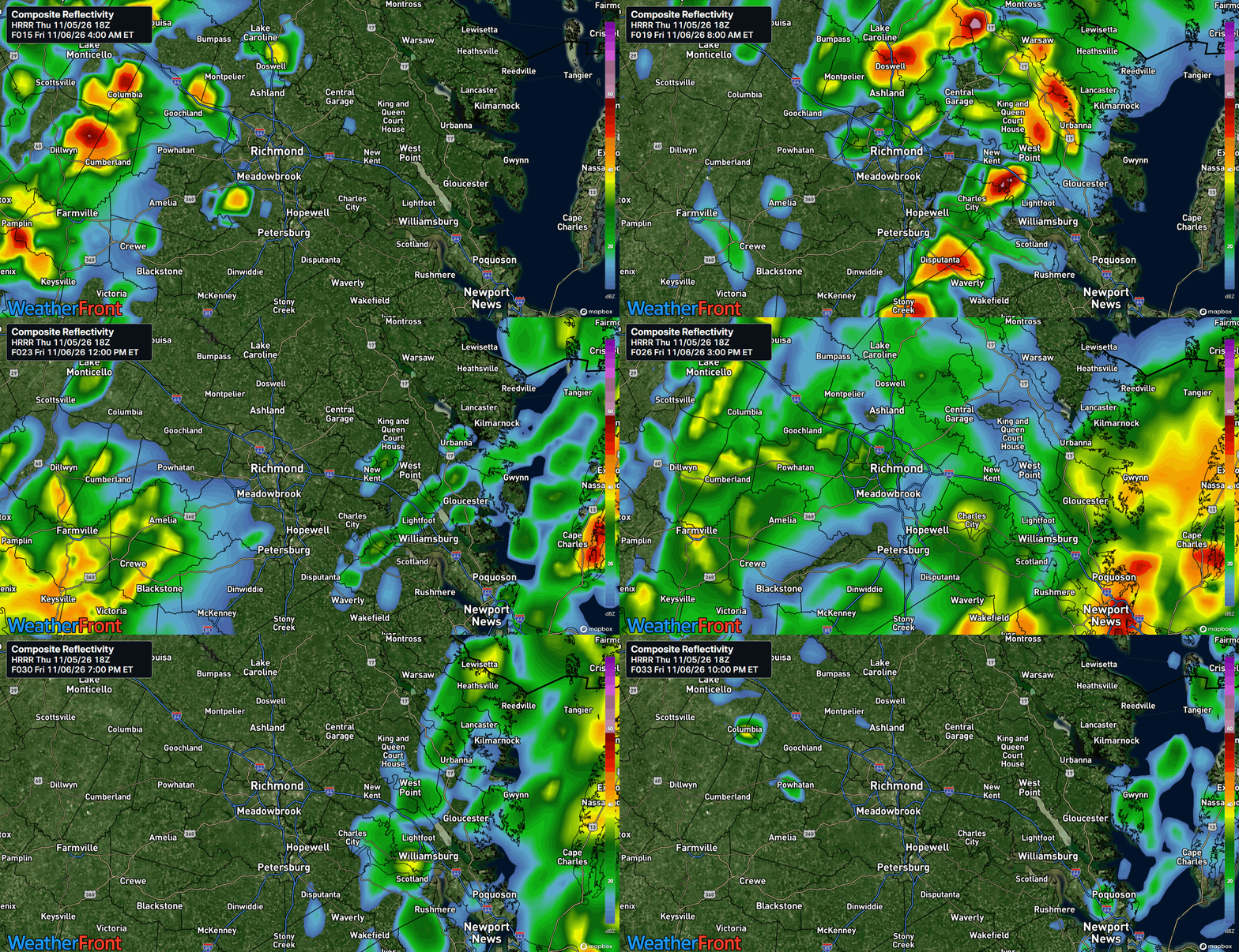
Saturday (Nov 7): Partly sunny, then sunny and much cooler as northwest flow takes over. High near 61 in the metro and Piedmont, low to mid 60s on the Northern Neck and Lower Eastern Shore, gusts 20-25 mph. Low around 41 in the metro, mid to upper 30s inland. The reset — dry, breezy, and finally seasonable.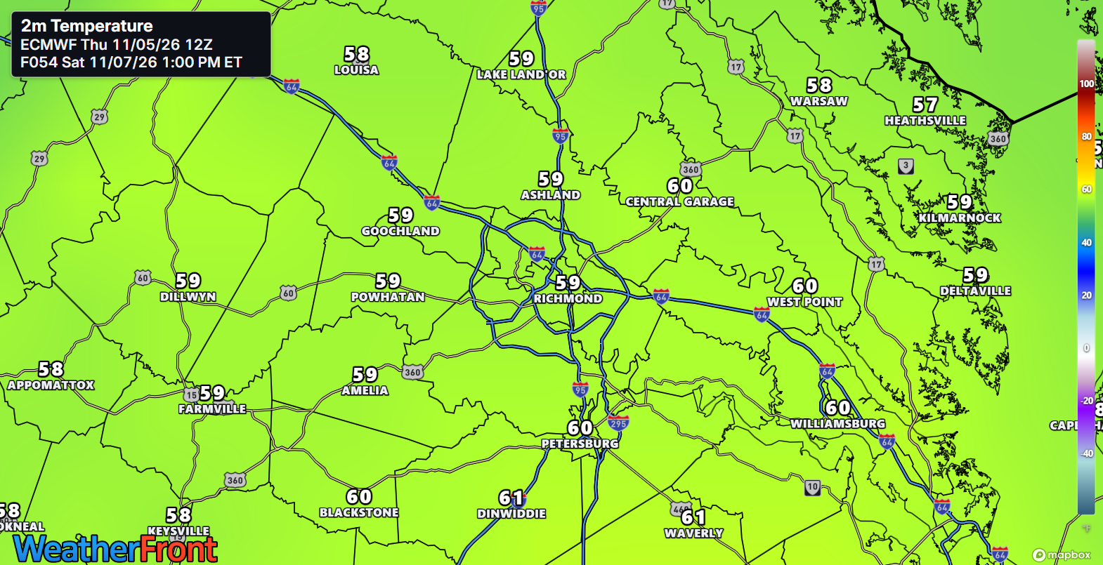
Sunday (Nov 8): Sunny and seasonably cool, high near 64 in the metro, low to mid 60s regionwide, lighter winds. Low around 40 in the metro, upper 30s inland. Dry weather holds into early next week. A quiet, bright close — November acting like November.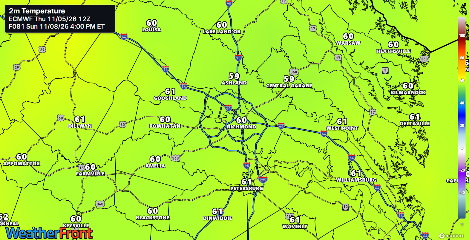
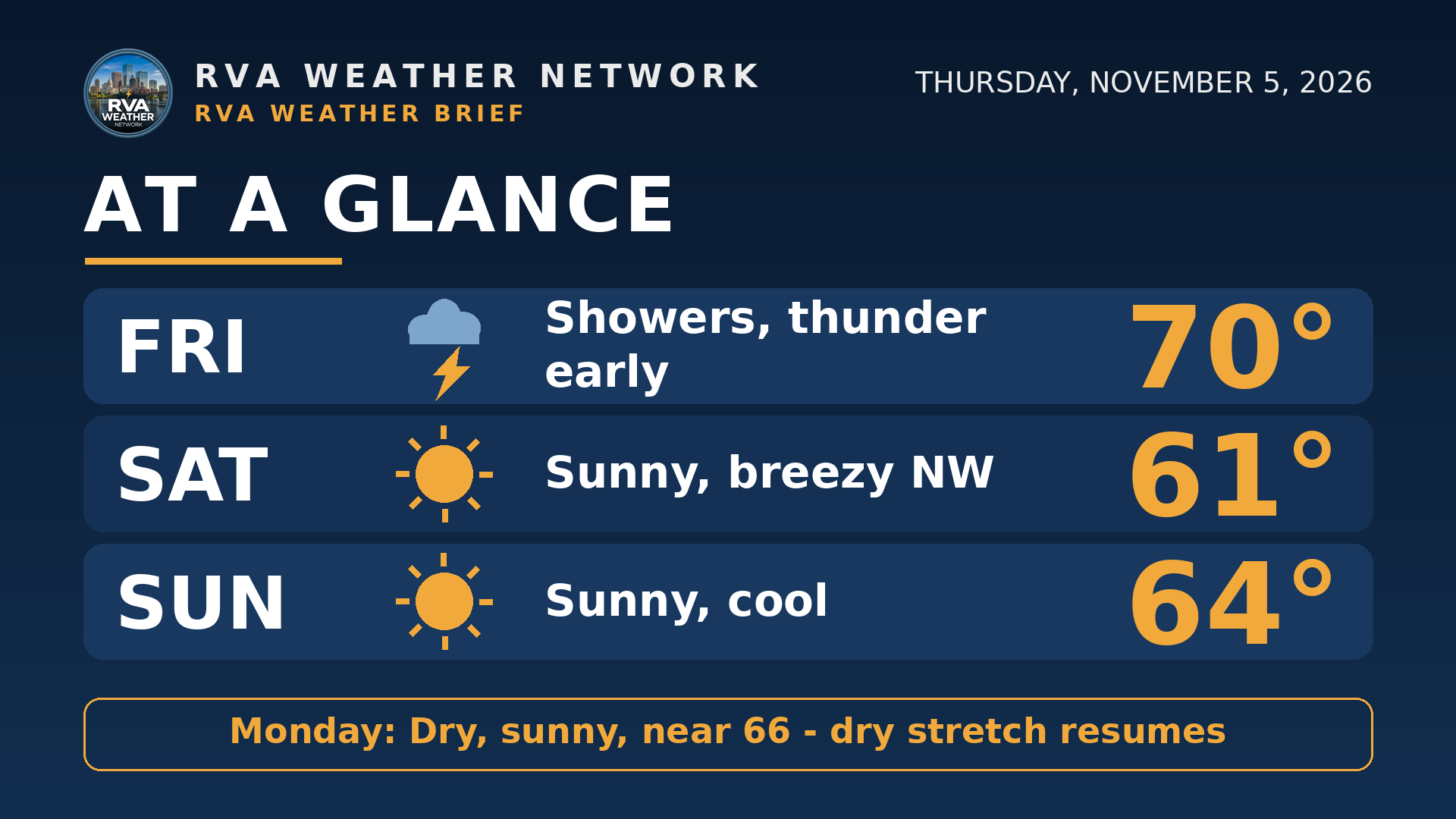
AT A GLANCE
Fri: Showers, thunder early — 70°
Sat: Sunny, breezy NW — 61°
Sun: Sunny, cool — 64°
Monday: Dry and sunny, near 66° — the dry stretch resumes
 SPECIALIZED CALLOUTS
🌱 Gardening & Soil Brief: Tonight-Friday's 1"+ in the metro (more east) is the deep soaking dry soil has waited for — let it do the watering, and check low beds Friday for standing water. Upper-30s inland lows Saturday night mean tender plants come in or get covered.
🚗 Commute & Outdoor Rating: 6/10. Friday is the hard day — heavy bursts can pond water on low spots, so allow extra time and never drive through flooded roads. Saturday is breezy but dry; Sunday is the pick.
🏠 Home & Energy Brief: Clear gutters and downspouts tonight before the heaviest rain arrives after 1 AM, and check sump pumps. Heating returns this weekend: lows near 40 end the open-window stretch.
🚴 Two-Wheel & Runner's Outlook: Friday is a treadmill day — wet roads, thunder, ponded water. Saturday is dry but blustery, gusts 20-25 mph on exposed stretches; Sunday rides best, starting near 40 and sunny by afternoon.
COMMUNITY ENGAGEMENT
📩 Reader Mailbag is open — send us your weather question: Pick a lane — RAIN, FLOODING, FROST, or WINTER — add your neighborhood, and send the full question at https://rvaweather.net/obs; we will answer one in an upcoming issue. Like this if your question has been sitting unasked.
📩 Share & Subscribe: Send this to anyone with Friday outdoor plans or a dry garden — tonight's totals decide both. Get the brief in your inbox: https://rvaweather.net/newsletter
❄️ Before you go — the winter guide is here: our free RVA Winter Outlook 2026–27 takes this El Niño story the rest of the way: the setup in plain English, CPC's warmer-and-wetter lean for Virginia, and all five El Niño winters in Richmond's record books — from 0.7 inches in 2023–24 to 29.4 inches in 1982–83, at nearly the same ocean signal. It's an outlook, not a snow forecast (the guide is stubborn about that distinction, and so are we), but it's the honest map of the season ahead. Grab it free here: https://buymeacoffee.com/rvawx/e/592397
Thanks for reading the RVA Weather Brief — 100% free, from the RVA Weather Network team. Support our work at https://rvaweather.net/social. Built on the latest NWS Wakefield forecast discussion (3:27 PM EST Thu Nov 5, 2026), with local context from the RVA Weather Network team. Keep an eye on the sky — and stay safe out there.